This is not a story of triumph, or a description of a route you may wish to climb. It’s more of a journal entry, coupled with beta for anyone wishing to establish a proper route on the Mt Ishbel Slab. If that interests you, read on, if not… continue your journey elsewhere.
Standing in a sunbeam, I took a moment to be mindful. The ground beneath my feet is cool, spongy. My shoes are heavy and sodden. My pants are saturated and plastered to my legs, chilling my blood. I exhale into the sunbeam, and feel like a dragon spewing mist. I pause at the bottom of my breath, and realize that the steam isn’t just coming from my lungs, but also from my shirt, and up from the earth around me.
We’re two hours into our approach of Mount Ishbel. We started our approach on electric scoots and ebikes, as is the way of the modern alpinist, before traveling through the meadow of the Hounds of Hades. Flattened circles of grass were littered with bones, an ominous way to start the day. We continued into a dense moist forest, passing a den made of deadfall, it’s occupants creaking and cracking branches as they stirred at our passing. And then we slogged.
The ‘Hillsdale Ridge Trail’ is not a trail in the normal sense of the word. It’s barely a route. It could more accurately be named ‘The Hillsdale Ridge Approach Swamp, featuring special guest, Deadfall’. In an effort to free ourselves of interminable deadfall crossings through hummocked marsh and saturated moss, I lead us up to a ridge. Less direct, but surely a ridge can’t also be a swamp? In fact in can. And the deadfall can be worse.
After my isolated moment of peace in my mindful sunbeam, our quest continued. Briefly, Gavin floated the notion that Acephale (a sport crag) or happy hour might be a better idea. I scoffed, and he clarified that he was just performing an ‘Insanity Check’, verifying that we were both insane and interested in continuing.
Three and a half hours into our approach, we finally reached the largest talus cone in the Rockies, and found it to be easier travel than expected. Four hours in, we were finally at the base of the gulley we’d been journeying towards.
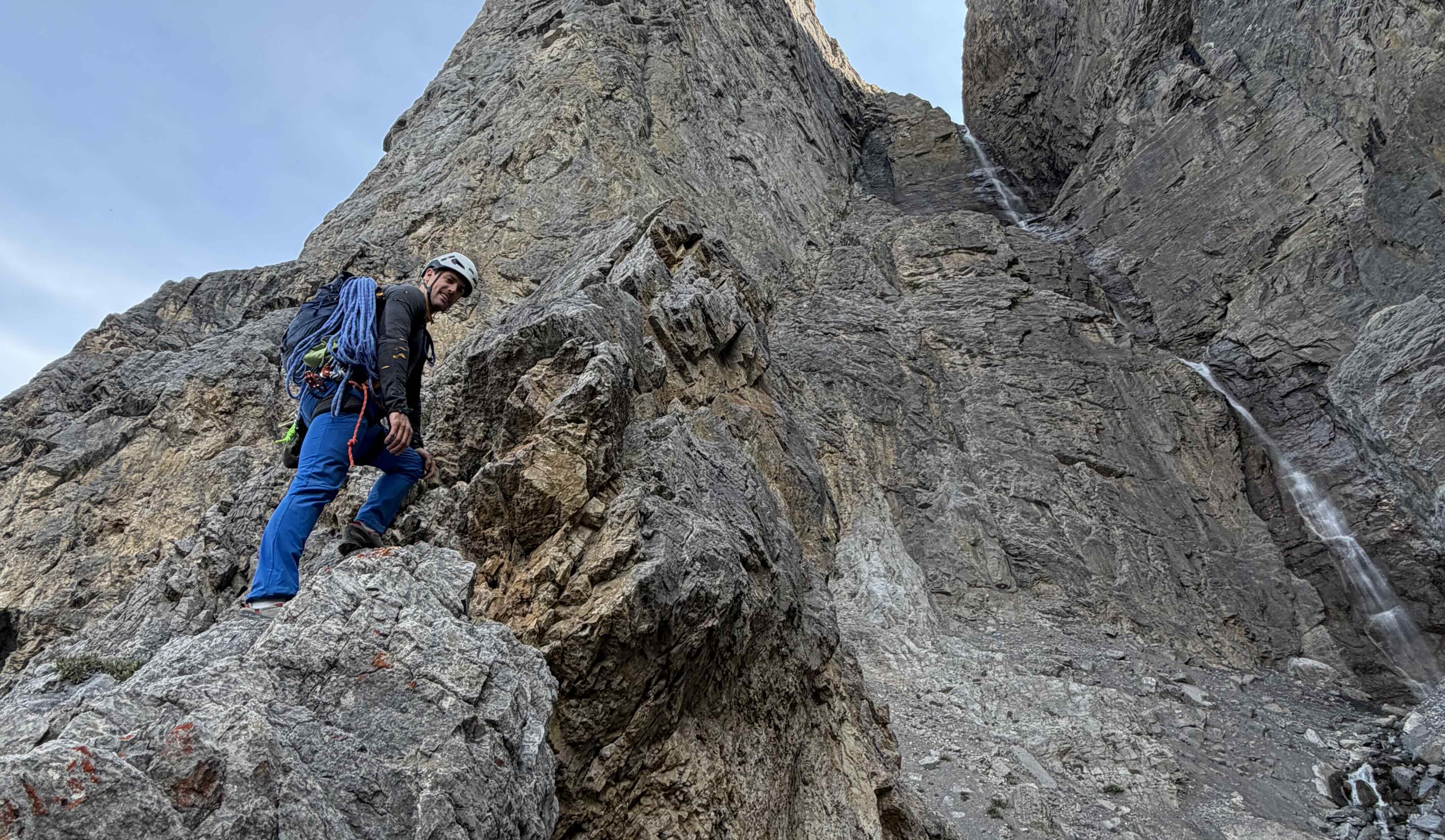
The feature we sought in the roof faced left, and we were approaching it from low and right. I began directly up the gulley, but found it insecure and water worn, and retreated climbers left onto the large loose rib that sits in the foreground of the main wall. Gavin pulled through the insecure gulley move and forged his own path. I’d pop back right on my rib to check on him periodically as we ascended. I had the looser of the lines, he had the far more technical and insecure solo.
Eventually we got high enough to see into our corner, and we were dismayed. It started as choss, then turned into a closed up corner without protection, then led to an impossible roof. The fifteen bolts we brought seemed woefully insufficient and we had already spent six hours of our day ‘approaching’. Rather than commit to a siege, we decided to continue scrambling up our respective features. Eventually we rejoined on the western ridge, and continued on to the ‘summit’ of the slab wall.
All this time, we’d carried a single rope, tag line, drill, hammer, single rack .1-3, double rack .2-4, nuts, two pitons, fifteen bolts and hangers, wrenches, three drill bits, a removable bolt… and all the other accoutrements. It seemed crazy to go all this way and take none of it out of our packs. We decided we should at least top-rope some sort of ‘final’ pitch on the headwall.
After some exploration, it seemed clear that the steep face directly beneath the summit could be climbed. I placed two bolts just below the lip, and lowered Gavin a full rope-length down it. He started back upward, and found perfect, sustained 5.10 slab face climbing. Fingertips wrap around thin edges, toes smear on small chert nodules, and periodically a fingertip-deep ledge provides a moment of easier movement and a stance.
The position was special beyond words. The slab extends forever below you, before cutting away beneath a roof and into the gulley below. Steep fins of rock reach towards the sky on both sides. The Louise Group and Castle Mountain reach towards the sky to your north. The Bow River winds through the Aftonroe marsh to your south. And all around, more rock fins of the aptly named Sawback range reach toward the sky.
Having gotten our fix, I pivoted again in my suggestion for our descent. We headed south down a series of gulleys between the bedding planes, periodically punching eastward into the next system. The terrain was lush by rockies standards, and we traveled across wooded ribs and down grassy gulleys in areas where one would expect nothing but screen. Still, the descent dragged on, and a final slab requied a 30m rappel to descend.
On our hike out we stayed more true to the ‘Trail’, and for a while it was much better than the way we took in. However, it steadily degraded into marsh, and the deadfall resumed. Perhaps in a drier part of the season it wouldn’t be such a suffer fest. In our wet September conditions, I finally fully lost my stoke at the 12-hour mark, with 1.5 hours and 1.5 kilometers left to the road.
The wall has so much potential. I’m very curious what an approach from Johnston Canyon would look like. It’s worth a long slog, but perhaps not a long slog through swamp and deadfall. My thoughts about this below.
Beta & Ideas
It’s so cool, and the terrain below promises perhaps another 150-200m more like it. The walls below are varied, but options exist for:
- An almost purely slab sport route, that connects blank faces by punching between the various layers of rock
- A sport route that connects unprotectable corners with good slab climbing. Many corners in the area are beautiful, but closed up, and could reasonably be equipped in a fully bolted mannner.
- A mixed protection route that attempts to give the best of both worlds. A con to this is that the approach is heinous, and a lighter (non-trad) rack would make it more enticing
Ishbel Slab Gulley - 250m, Low-Fifth R - FA Gavin McNamara
An inadvisable undertaking. From the top of the scree cone, climb directly up the gulley until you join with the left face. Protection is scant, rock is a combination of loose and waterworn, and rockfall exposure is high.
Ishbel Slab Approach Ridge - 300m, Fourth Class - FA Greg Barrett
A better way to ascend toward the Ishbel Slab. Start up the gulley, but break leftward onto the ridge at your first opportunity. The climbing sits in the awkward middle ground where it is high-consequence enough to warrant a rope, but easy and rambly enough to make a rope a nuisance. The rock does not offer great opportunities for traditional protection, but good use of terrain could provide a measure of safety to a roped party.
Ishbel Slab Headwall - 60m, 5.10, Top-Roped by Gavin McNamara and Greg Barrett
I certainly can’t call a top-rope session a first ascent, but this is what we did. I would suggest the tounge-in-cheek route name ‘Forest Bathing’ to a party that finishes this way on a proper first ascent. Maybe that will be us.
Approach
If approaching from below, the ‘Hillsdale Ridge Trail’ coming from the east, found on some basemaps, does work, but is unplesant. Don’t ascend ridges climbers left if you do this, stay in the valley. The deadfall and travel will improve eventually.
If approaching from below, consider the ‘Hillsdale Ridge Trail’ coming from the Ink Pots at Johnston Canyon. The overall distance is longer, but much of that will be fast an on a maintained trail. Let me know how it goes.
If approaching from above (top-down bolting), consider either Hillsdale Ridge Trail, followed by the ‘Ishbel Slab Approach Ridge’.
If approaching from above (top-down bolting), also consider the West Ridge, which is the start of #61 West Ridge-South Ridge Traverse as documented in Rockies Central. It is also documented as a descent here Ruari Macfarlane - New Rockies Routes
Decent
Descending south down gulleys as we did does work, and lets you head back east, however it is relatively time-consuming.
A bolted rappel descent would be advantageous. If it followed the climbing line down into the gulley, it might be disireable to have it regain the foreground ridge and rappel down the face of it, versus continuing down the gulley which would be highly rockfall prone, both in terms of core shots, getting hit, and bolts getting flattened. Alternatively, a bolted rappel could start from the top of the gulley height, but go down the foreground face, which would be longer but potentially quite clean.
Descending the west ridge as described in the ascent section above might make a lot of sense if coming from Johnston. It’s not clear whether it would be better to rappel all the way down first and then head west, or head west down the ridge.